Ikonos

Results: 211


#Item
21Using Satellite Imagery In Disaster Management By George Tabakian Space Imaging Middle East

Using Satellite Imagery In Disaster Management By George Tabakian Space Imaging Middle East

Add to Reading List

Source URL: www.unoosa.org

Language: English - Date: 2005-11-28 05:23:54
22‘Remote Sensing Solutions for Disaster Management – CSIR’s Experience in Africa. Alex Fortescue Copyright CSIR/SAC

‘Remote Sensing Solutions for Disaster Management – CSIR’s Experience in Africa. Alex Fortescue Copyright CSIR/SAC

Add to Reading List

Source URL: www.unoosa.org

Language: English - Date: 2005-11-23 09:49:22
23 Земно покритие на гр. Русе по метода LCCS на FAO на база спътниково изображение Ikonos (1m)

Земно покритие на гр. Русе по метода LCCS на FAO на база спътниково изображение Ikonos (1m)

Add to Reading List

Source URL: bsdi.asde-bg.org

Language: Bulgarian - Date: 2011-06-20 10:13:44
    24Cover Story  Multi-Temporal Aerospace Imagery in Coastal Dynamics Studies at Kara Sea By S. Ogorodov1, N. Belova2, D. Kuznetsov3, A. Noskov4

    Cover Story Multi-Temporal Aerospace Imagery in Coastal Dynamics Studies at Kara Sea By S. Ogorodov1, N. Belova2, D. Kuznetsov3, A. Noskov4

    Add to Reading List

    Source URL: www.zikj.ru

    Language: English - Date: 2013-03-19 15:05:00
    25Promises and Problems The Worldwide Growth in Remote Sensing Capabilities U.S. Department of the Interior U.S. Geological Survey

    Promises and Problems The Worldwide Growth in Remote Sensing Capabilities U.S. Department of the Interior U.S. Geological Survey

    Add to Reading List

    Source URL: calval.cr.usgs.gov

    Language: English - Date: 2015-05-14 16:47:40
    26Geomatica OrthoEngine v10.2 Tutorial  DEM Extraction of IKONOS Data IKONOS, launched on September 24, 1999 is a commercial earth observation satellite by GeoEye. IKONOS was the first commercial satellite to amass high re

    Geomatica OrthoEngine v10.2 Tutorial DEM Extraction of IKONOS Data IKONOS, launched on September 24, 1999 is a commercial earth observation satellite by GeoEye. IKONOS was the first commercial satellite to amass high re

    Add to Reading List

    Source URL: www.pcigeomatics.com

    Language: English - Date: 2015-04-28 10:36:26
    27NAVAL POSTGRADUATE SCHOOL MONTEREY, CALIFORNIA  THESIS

    NAVAL POSTGRADUATE SCHOOL MONTEREY, CALIFORNIA THESIS

    Add to Reading List

    Source URL: www.nps.edu

    Language: English - Date: 2013-06-21 18:33:56
    28A Brief Survey of Remote Sensing Law Around the World U.N./Nigeria Workshop on Space Law Presented by Prof. Joanne Irene Gabrynowicz 23 November 2005

    A Brief Survey of Remote Sensing Law Around the World U.N./Nigeria Workshop on Space Law Presented by Prof. Joanne Irene Gabrynowicz 23 November 2005

    Add to Reading List

    Source URL: www.unoosa.org

    Language: English - Date: 2005-12-02 06:14:20
    29

    PDF Document

    Add to Reading List

    Source URL: www.pcigeomatics.com

    Language: English - Date: 2014-06-18 17:01:54
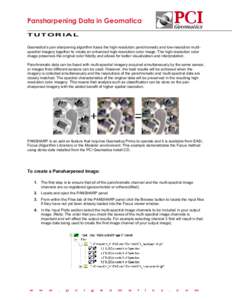
    30Pansharpening Data in Geomatica TUTORIAL Geomatica’s pan sharpening algorithm fuses the high-resolution panchromatic and low-resolution multispectral imagery together to create an enhanced high-resolution color image.

    Pansharpening Data in Geomatica TUTORIAL Geomatica’s pan sharpening algorithm fuses the high-resolution panchromatic and low-resolution multispectral imagery together to create an enhanced high-resolution color image.

    Add to Reading List

    Source URL: www.pcigeomatics.com

    Language: English - Date: 2013-10-14 14:14:40