<--- Back to Details
First PageDocument Content
Planetary science / Landsat 7 / Landsat program / Normalized Difference Vegetation Index / Satellite imagery / METRIC / Geographic information system / Wetland / Multispectral pattern recognition / Earth / Spacecraft / Remote sensing
Date: 2015-04-30 09:55:02
Planetary science
Landsat 7
Landsat program
Normalized Difference Vegetation Index
Satellite imagery
METRIC
Geographic information system
Wetland
Multispectral pattern recognition
Earth
Spacecraft
Remote sensing

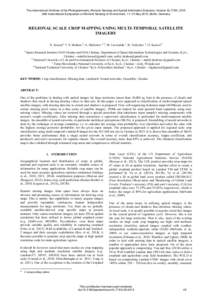
The International Archives of the Photogrammetry, Remote Sensing and Spatial Information Sciences, Volume XL-7/W3, 2015 36th International Symposium on Remote Sensing of Environment, 11–15 May 2015, Berlin, Germany REG

Add to Reading List

Source URL: www.int-arch-photogramm-remote-sens-spatial-inf-sci.net

Download Document from Source Website

File Size: 4,28 MB

Share Document on Facebook

Similar Documents

E a r t h S c i e n c e E n t e r p r i s e ’s I m p r o v e d MODIS Features: • Atmospheric measurements of a variety of biological and physical

E a r t h S c i e n c e E n t e r p r i s e ’s I m p r o v e d MODIS Features: • Atmospheric measurements of a variety of biological and physical

DocID: 1pC8z - View Document

Final conference  Comparison of methods for thematic map preparation and map validation Linda Gulbe

Final conference Comparison of methods for thematic map preparation and map validation Linda Gulbe

DocID: 1frQQ - View Document

The International Archives of the Photogrammetry, Remote Sensing and Spatial Information Sciences, Volume XL-7/W3, 2015 36th International Symposium on Remote Sensing of Environment, 11–15 May 2015, Berlin, Germany REG
The International Archives of the Photogrammetry, Remote Sensing and Spatial Information Sciences, Volume XL-7/W3, 2015 36th International Symposium on Remote Sensing of Environment, 11–15 May 2015, Berlin, Germany REG

DocID: 1a3Ds - View Document

P a k i s t a n  S p a c e a n d

P a k i s t a n S p a c e a n d

DocID: 18BWd - View Document

International Journal of Remote Sensing Vol. 27, No. 3, 10 February 2006, 473–491 Sub-pixel mapping of rural land cover objects from fine spatial resolution satellite sensor imagery using super-resolution pixel-swappin

International Journal of Remote Sensing Vol. 27, No. 3, 10 February 2006, 473–491 Sub-pixel mapping of rural land cover objects from fine spatial resolution satellite sensor imagery using super-resolution pixel-swappin

DocID: 15MAp - View Document